


47 km | 82 km-effort

Utilisateur


Application GPS de randonnée GRATUITE
 SityTrail
IGN / Instituts géographiques
SityTrail World
Le monde est à vous
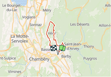
Randonnée V.T.T. de 18,7 km à découvrir à Auvergne-Rhône-Alpes, Savoie, La Ravoire. Cette randonnée est proposée par tracegps.
Circuit proposé par Alpes Tour Départ La Ravoire/ Saint Alban Leysse. Ce parcours débute par une route en bitume en direction de Saint Jean d'Arvey. Après avoir passé un tunnel, nous quittons la D912 pour un sentier en forêt sur une légère pente montante. La suite des infos indispensables est ICI


Course à pied

Marche

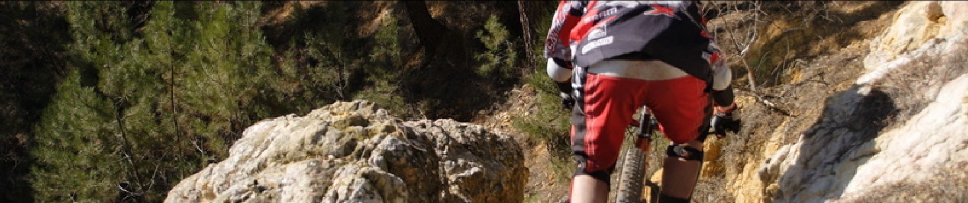
V.T.T.

Vélo

Marche
V.T.T.

Marche
Marche
V.T.C.